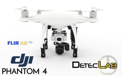
DJI Phantom 3 Professional
Thermal Archaeology Drone
Want to find more and bigger? Deteclab brings you the first aerial easy-to-use solution for treasure findings.
In using same technology than archaeologists, this state-of-the-art tool has been developed especially for archaeologists/treasure hunters who are looking for new archaeological sites in large fields or difficult access places like mountains, forests, deserts, ...
Unlike traditional long range detectors, this solution will give you the more quickest method to localize and detect ancient human activities like ruins.
RGB mode
All of the aerial photographs taken during the survey are downloaded and run through computer software to create a 3D model and map of the landscape. This process gives us the opportunity to see the landscape in greater detail, as well as highlighting features in the landscape which may not have been recorded in previous topographical (land) surveys or even seen before. These images show what the resulting map looks like in the computer software – you can also take a look around the 3D map yourself

IR mode
An IR thermography camera produces a thermogram, a visual representation of the temperatures of the object, with different colours representing different temperature ranges. In most cases low temperatures are represented by dark colours and high temperatures by lighter ones.
Various parameters are linked to a thermogram, some of which strongly influence the results. For example the emission value, reflectivity, humidity and the type of camera used. The camera provides information on the resolution of the detector, IFOV (Instantaneous Field of View) and the temperature range. Other important parameters are linked to the scope of the thermographic measurement. The best results are achieved in cases with temperature differences of at least 10 degrees Celsius between the object and its environment. This makes winter the most suitable season for drone IR thermography in the open air.
This complete thermal imaging camera and 2-axis gimbal system come integrated with the Phantom 3 Professional edition quadcopter from DJI. In addition to thermal video, the camera is capable shooting up to 12 MP still photos using JPEG or non-proprietary DNG RAW format. The three axes of the gimbal give you pan and tilt control, and keep the horizon line level even as the aircraft banks. Different gimbal settings allow the camera to lock onto a fixed subject, be moved manually using transmitter rotaries or the app, or to simply provide camera stabilization.
Aftersale support will provide you all necessary informations and tricks depending your searching location.
Now you won't waste your time to search because you will be able to know exactly where to find targets with your metal detectors.
Camera Control and Live 720p Monitoring
View a live 720p HD image with the free Pilot mobile for Android or iOS mobile device. The app also enables full camera control, letting you set parameters such as camera tilt, ISO, shutter speed, white balance as well as set video start/stop and take photos. The mobile device tethers to the transmitter via USB (cable available separately). A wireless range of up to 3.1 miles line-of-sight is provided (depending on conditions)

In-App Editing and Upload
Once recorded, photos and video footage can be downloaded directly to the phone allowing them to be edited complete video with music, text, and more, and shared on Facebook, Instagram, or other social media networks - even while the Quadcopter is still in the air. If you have an Internet connection, you can even stream live to YouTube
Flight Simulator
The app isn't just for flying. A flight simulator allows you to get some practice in before taking to the skies. A flight log allows you to review all of your past flights, with the time, duration, and even photos and videos you took
Live Map and Radar
See yourself or your flight platform on a live map, and log exactly where you are filming
On-Board 4K and Thermal Imaging Cameras
Receive both live video camera signals on separate screens (thermal and RGB source).
Change thermal camera pan and tilt axis remotly
Auto-Takeoff
With one tap in the DJI Pilot app, the Phantom 3 will turn on its motors and raise to a pre-set height. It will then hover in place, completely motionless until you direct it where to go
Auto-Landing
When GPS is available, the Phantom 3 remembers the exact spot that it took off from. Simply tap a button to have it return to the point from which it took off
Return to Home Failsafe
If the Quadcopter loses the signal from the controller for any reason or the battery starts to run low the "return to home" feature will initialize. The aircraft will ascend to 60 feet then make a straight-line course back to the "home position" you will have defined during the GPS calibration process. Once there, it will safely descend to the ground and power itself off
What is in the box?
- DJI Phantom 3 Professional
- Flir Gimbal with lipo battery and charger
- User manual
Optional: Flir camera


